
RoadScan-GPR Pavement and Roadway Assessment
High-speed GPR scanning for pavement layer thickness and road condition evaluation
RoadScan-GPR Pavement Assessment
RoadScan-GPR is a ground penetrating radar–based system used to evaluate pavement layer thickness and roadway conditions in a non-destructive manner. This approach is commonly used for transportation infrastructure assessments where traditional coring alone would be time-consuming, disruptive, or impractical across large roadway sections.
By integrating GPR data with ground truth information from select core samples, RoadScan-GPR provides a comprehensive view of pavement structure and variability along the surveyed route.
Planning and Data Collection
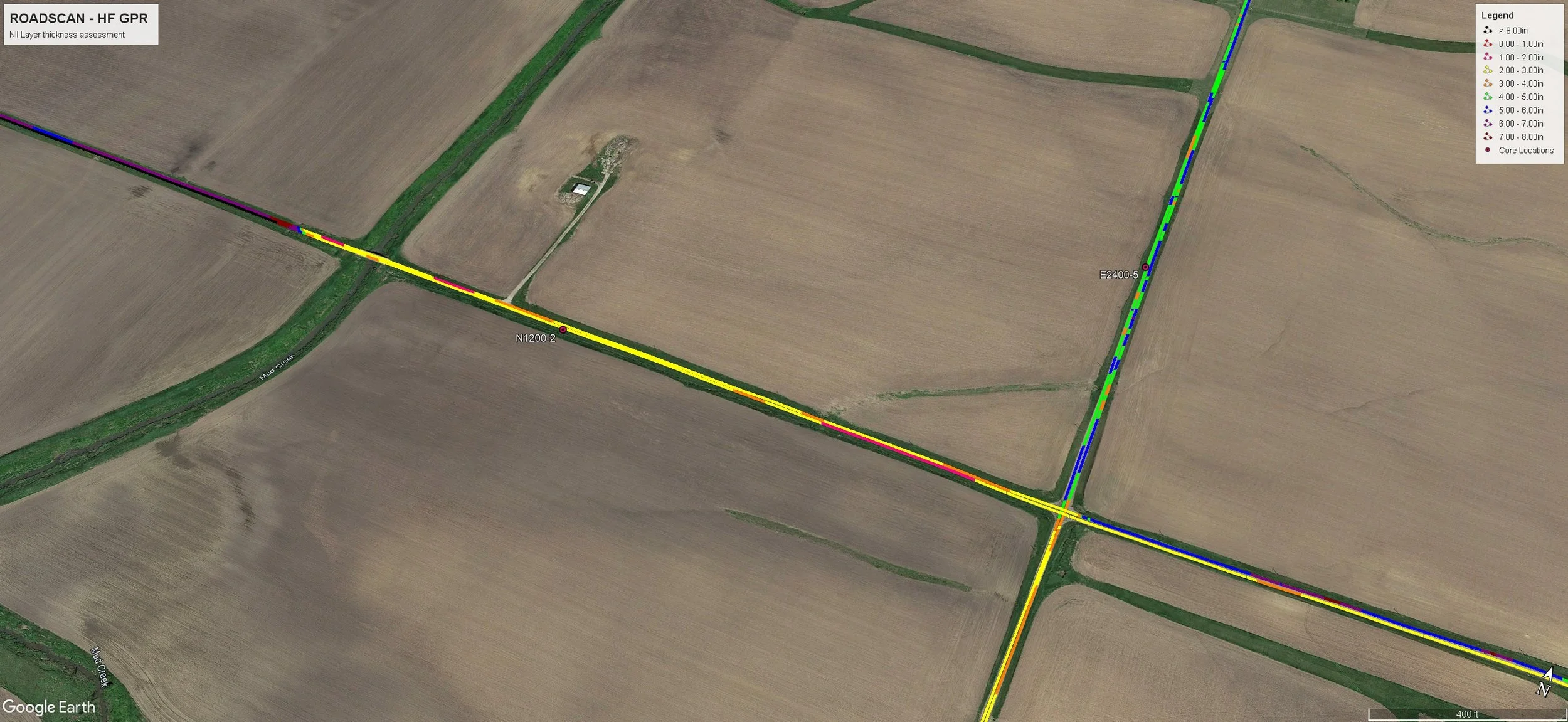
RoadScan-GPR assessments typically begin with planning and calibration activities. Core samples are obtained at selected locations along the investigated roadway to support radar signal calibration and validation. These core samples provide physical measurements of pavement layers, material descriptions, and reference points for GPR interpretation.
Following calibration, GPR scanning is performed using a dedicated RoadScan system at a typical horizontal sampling rate of 1–2 scans per foot. Individual GPR scan lines are collected along the roadway alignment and around calibration locations to ensure data consistency.
Data Processing and Analysis
After data acquisition, collected radar data undergoes pre-processing and post-processing to support interpretation and analysis. This process may include signal normalization, vertical and horizontal scaling, signal-to-noise filtering, frequency filtering, and signal velocity determination.
Processed data is analyzed to determine pavement layer thickness, identify changes in subsurface conditions, and evaluate roadway uniformity. Numeric thickness information may be exported in ASCII format to support spreadsheet analysis and reporting.
GIS Integration and Reporting
RoadScan-GPR results can be integrated into a GIS environment, allowing pavement thickness and condition data to be spatially referenced along the roadway. Deliverables may include GIS-based maps, charts, and visualizations that illustrate thickness variations and subsurface trends.
Final outputs may also incorporate GPS-referenced GPR imagery, summary reports, and optional video files synchronized with GPR and location data to support asset management and planning decisions.
Advantages of RoadScan-GPR
RoadScan-GPR offers several advantages for roadway assessments, including:
Rapid data acquisition over long distances
Ability to collect data at highway speeds (up to 60 mph)
Reduced traffic disruption compared to traditional methods
Comprehensive GIS-based deliverables
Non-destructive evaluation of pavement structure
Important Considerations
RoadScan-GPR is a non-destructive, interpretive assessment method. Accuracy depends on calibration data, material properties, and site conditions. GPR results do not replace engineering judgment, and final decisions regarding rehabilitation or design should be made by qualified professionals.
Planning a Roadway or Pavement Assessment?
RoadScan-GPR provides efficient, data-driven insight into pavement structure and condition.

Color-coded pavement thickness map showing layer thickness variations along roadway network.
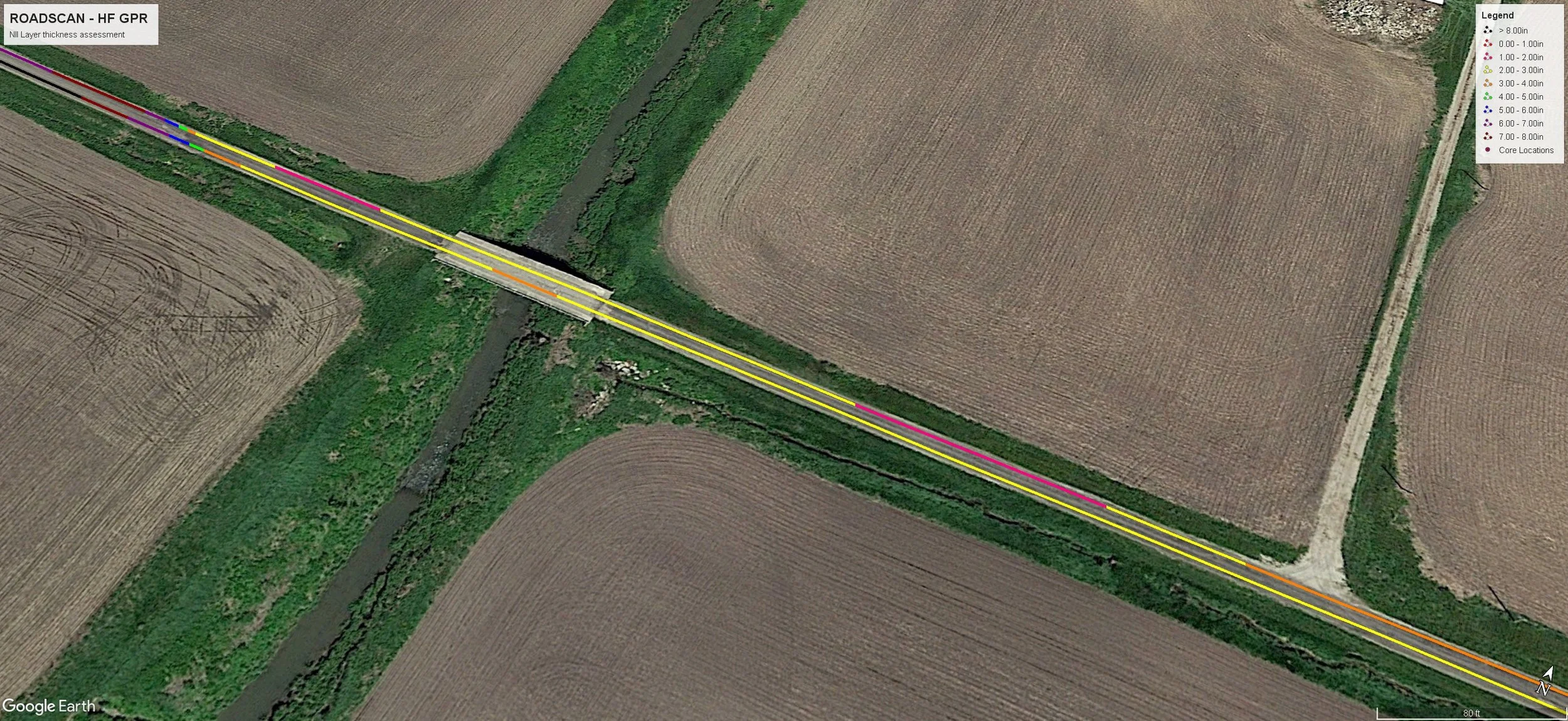
RoadScan-GPR assessment displaying pavement thickness data georeferenced to roadway alignment.
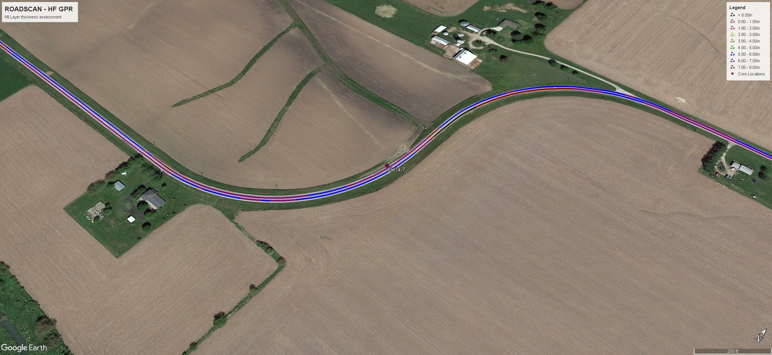
GIS-integrated pavement assessment showing thickness distribution and core sample locations.