

3D Laser Scanning
3D laser scanning and reality capture services for construction, industrial and infrastructure projects in Houston and Dallas, Texas.
How it works.
3D laser scanning is a reality capture technology that uses high-frequency laser pulses to measure millions of spatial data points across a surface or structure. Those points are combined into a highly accurate 3D point cloud - a digital representation of the physical world that can be measured, analyzed and shared without returning to the site.
OmniVueNDT uses FARO laser scanning systems to capture precise spatial data for construction, industrial and infrastructure projects. The captured data supports quality control, as-built documentation, design coordination and structural assessment across a wide range of applications.
Applications
-
3D Laser Documentation for BIM & MEP
High-resolution laser scanning captures existing site conditions and generates accurate 3D point clouds for BIM modeling, as-built documentation and design coordination. Data can be exported in DXF or DWG format for direct integration into downstream design platforms.
-
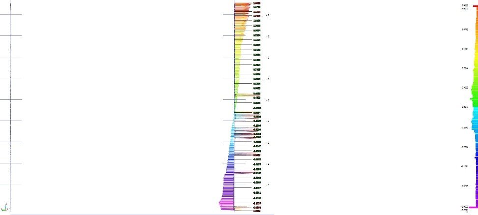
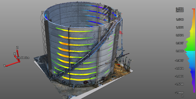
Storage Tank Deformation Analysis
3D LiDAR scanning provides precise geometric assessment of above-ground storage tanks - evaluating verticality, shell deformation, settlement and roundness without physical contact or destructive testing.
-
Reasons to Use OmnivueNDT Laser Scanning Services Near Houston and Dallas, TX
AST, Atmospheric Storage Tank inspections specified by API-653 Standards
Verticality, Shell deformation and Settlement check
Comprehensive Metrology TANK Inspections
Precise, high-speed data collection
Dimensionally accurate, measurable and shareable data sets
Eliminates site revisits for missed measurements
Improves project collaboration and coordination
Produces accurate design plans from the start
Reduces change orders, delays and costs
Local scan technicians