
How Ground Penetrating Radar (GPR) Works: A Complete Guide for Construction and Engineering Professionals
What is Ground Penetrating Radar (GPR)?
Ground Penetrating Radar (GPR) is a non-destructive testing (NDT) method that uses high-frequency electromagnetic (EM) waves (typically 40–1,500 MHz) to scan and map subsurface conditions. Widely used in construction, engineering, and infrastructure projects, GPR helps identify hidden objects and structural anomalies before excavation, coring, or heavy load placement begins.
By providing real-time imaging of subsurface features, GPR plays a critical role in improving safety, reducing risk, and preventing costly damage.
How GPR Works
GPR systems transmit electromagnetic pulses into the ground through a surface-coupled antenna. When these signals encounter changes in material properties—such as differences in density, moisture content, or dielectric constant—they reflect back to the surface and are recorded by a receiver.
These reflections may come from:
Soil layers and horizons
Groundwater surfaces or moisture zones
Rock, boulders, or voids
Embedded objects (rebar, post-tension cables, conduits)
Underground utilities and infrastructure
The data is processed instantly and displayed as a 2D cross-sectional image (radargram). As the antenna moves across the surface, technicians can visualize subsurface conditions in real time and adjust scanning methods as needed.
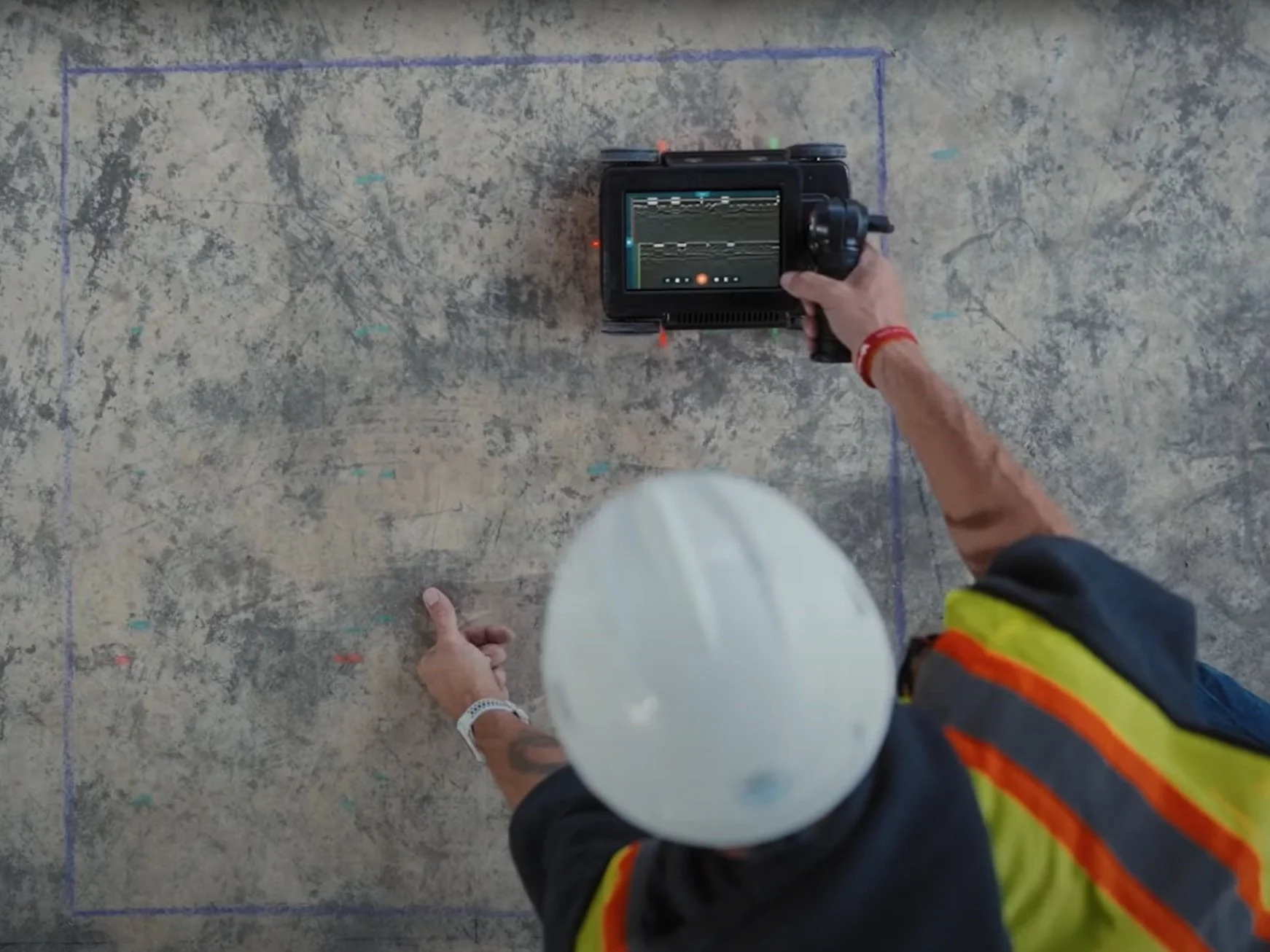
An OmniVueNDT technician conducting a concrete slab scan with real-time radargram data displayed on the GPR unit.
The radargram below illustrates what that real-time data looks like as the signal is transmitted and reflected back to the surface.

Figure 1 - GPR received signal and graphic profile display. (Benson, Glaccum, and Noel, 1983)
Resolution vs. Depth: Understanding GPR Performance
GPR performance depends heavily on antenna frequency and ground conditions:
Higher frequencies provide greater resolution but shallower penetration
Lower frequencies allow deeper penetration with reduced detail
In most environments, GPR penetration depths are limited to approximately 30 feet, depending on soil composition.
Highly conductive materials—such as clay soils or groundwater with high salinity—can significantly reduce signal penetration due to increased attenuation.
Key Material Properties That Affect GPR
Two primary physical properties influence how GPR signals behave:
Electrical Conductivity (σ): Higher conductivity increases signal loss, reducing depth of investigation
Dielectric Constant (ε): Determines how fast EM waves travel through a material; higher values (e.g., water) slow signals and increase attenuation
Understanding these properties allows experienced technicians to accurately interpret GPR data and identify subsurface anomalies.

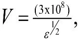
where
V= velocity in m/s,
ε = dielectric constant (dimensionless),
a= attenuation in decibels/m (db/m),
σ = electrical conductivity in mS/m.
Table 1. Electromagnetic properties of earth materials

Wightman, W. E., Jalinoos, F., Sirles, P., and Hanna, K. (2003). "Application of Geophysical Methods to Highway Related Problems." Federal Highway Administration, Central Federal Lands Highway Division, Lakewood, CO, Publication No. FHWA-IF-04-021, September 2003.
Common Applications of GPR in Construction
GPR is an essential tool across a wide range of applications, including:
Concrete Scanning: Locating rebar, post-tension cables, and conduits before coring or cutting
Utility Locating: Identifying buried pipes, tanks, and electrical lines prior to excavation
Void Detection: Detecting subsurface voids, sinkholes, and soil washout beneath slabs or pavement
Structural Assessment: Evaluating existing infrastructure for hidden defects
Moisture & Groundwater Mapping: Identifying saturation zones and drainage issues
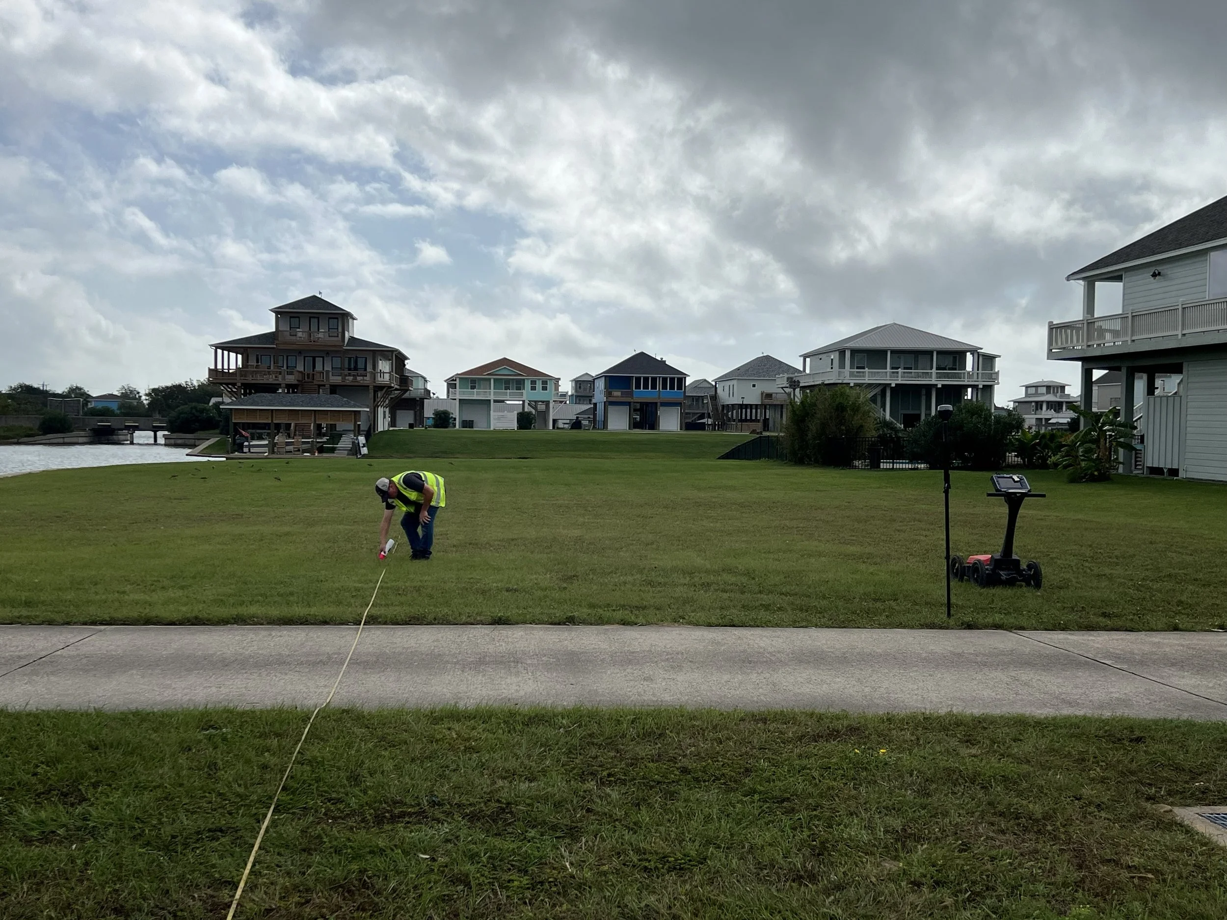
An OmniVueNDT field technician setting scan lines for a ground-coupled GPR survey during a residential utility locating project.
Because subsurface conditions are often unpredictable, field technicians adapt scanning techniques in real time to ensure the most accurate results.
Why GPR is Critical for Risk Mitigation
The primary objective of GPR surveys is to map near-surface features and detect changes in subsurface geometry. Without this insight, construction projects face significant risks, including:
Structural damage during drilling or coring
Utility strikes leading to safety hazards and costly repairs
Undetected voids causing settlement or failure
Project delays due to unforeseen subsurface conditions
GPR provides the data needed to make informed decisions, ensuring safer, more efficient project execution.
Work With OmniVueNDT
At OmniVueNDT, we specialize in advanced GPR scanning services that help engineers, contractors, and project managers mitigate risk and maintain structural integrity. Our team delivers accurate, real-time subsurface data in compliance with ASTM D6432 standards, supporting projects across commercial, industrial, and infrastructure sectors.
Whether you're planning a concrete scan, utility investigation, or subsurface condition assessment, we provide the expertise needed to keep your project safe and on schedule.
Get Started Today
📧 Email: info@omnivuendt.com
🌐 Services: GPR Scanning | Void Detection | Utility Mapping | Structural Assessment
Contact OmniVueNDT today to schedule a scan and eliminate subsurface uncertainty before it becomes a costly problem.