
Industrial Void Mapping: Why Ground Conditions Belong in Every Lift Plan
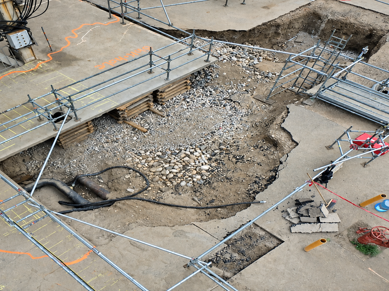
Every crane lift is planned around the load, the boom and the rigging, but the entire operation rests on what's beneath the outriggers. A concrete pad or paved surface can look perfectly sound while a void, washout or buried utility sits just below it. If that ground gives way under a heavy load, a crane or above-ground structure can collapse. Industrial Void Mapping, part of OmniVueNDT's Subsurface Condition Assessment service, uses Ground Penetrating Radar (GPR) to find those hidden hazards before the crane is set up.
What OSHA Requires
OSHA's crane standard for construction makes ground conditions a formal part of lift planning. It places responsibility for ground conditions on the party in control of the site. That party must also inform the crane user and operator of hazards beneath the set-up area, such as voids, tanks and utilities, when those hazards appear in site records or are otherwise known.
The standard addresses hazards that are already known. Drawings can be outdated or incomplete, and OmniVueNDT's own GPR work has found construction that differs from the as-built drawings. Industrial Void Mapping gives planners current data on what is actually in the ground rather than relying on records alone.
How It Works
Heavy lifting in refineries, chemical plants and industrial facilities begins with a Job Safety Analysis and Job Hazard Analysis. A subsurface study of the lifting zone is one of the most important parts of that assessment. Working with plant engineers, planners and craning and rigging teams, OmniVueNDT scans the lifting zone and surrounding area with GPR. The survey detects subsurface abnormalities such as voids, sinkholes and washouts as well as buried pipes and utilities. GPR survey systems produce 3D data of the scan area, and all work is performed in accordance with ASTM D6432.
What You Receive
The primary result is an accurate void and utility map that identifies clear areas for the crane setup and outriggers. The void map is overlaid on a 2D or 3D satellite base map with latitude, longitude and depth information. Depending on your requirements, it can be delivered as a GIS map or a survey-grade drawing. The assessment can also produce a pavement thickness map that shows variations in concrete thickness across the lifting zone, so thin areas can be avoided.
When to Schedule a Survey
The best time is during planning, before the lift is scheduled and before equipment arrives on site. It is especially valuable for heavy crane placements, lifts inside operating facilities, turnaround work and sites where records are incomplete or ground conditions may have changed. For a closer look at the process in the field, see our case study on Subsurface Condition Assessment for crane placement.
Map before you lift. Contact OmniVueNDT at 1-800-605-9735 to schedule Industrial Void Mapping ahead of your next crane placement.