
Subsurface Utility Investigation (SUI) at a Major Industrial Facility: Navigating Hidden Risks Below the Surface
When a large industrial facility planned to install new pipe racks to support critical process piping, the project team faced a challenge many construction and engineering leaders know all too well: what lies beneath the ground could make or break the entire project.
This particular facility - a complex network of existing utilities, conduits and infrastructure - had decades of accumulated subsurface changes. As the team prepared for excavation and installation of heavy assembly components, outdated drawings, incomplete records and undocumented utilities posed significant risks. Installing new pipe racks without accurate knowledge of buried lines could result in:
Strikes on gas, electrical or fiber-optic lines that cause safety incidents or prolonged outages
Unexpected utility damage that halts work, incurs costly repairs and attracts regulatory fines
Contractor liability for injuring workers or damaging third party infrastructure
Delays of weeks or months as utilities are exposed and rebuilt
Recognizing these stakes, the client engaged OmniVueNDT to conduct a Subsurface Utility Investigation (SUI) focused on uncovering what the record drawings couldn’t reliably show.
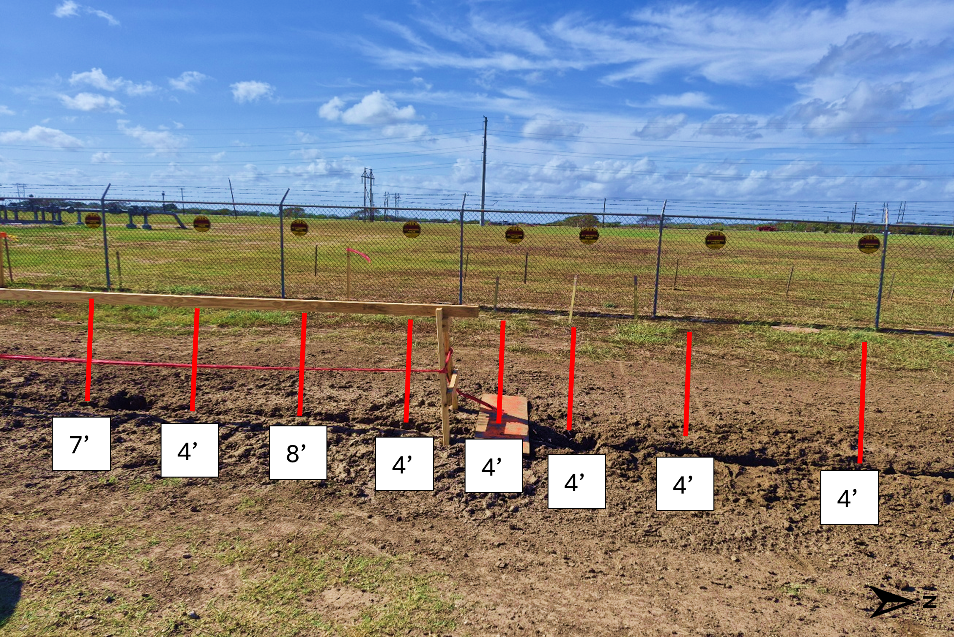
The outcome of the survey is seen below and presented in the appropriate CRS (Coordinate Reference System) and EPSG code system. Each located utility or pipe was also labeled in accordance with their known designation. The image shows the field survey area where OmniVueNDT technicians identified and marked multiple underground utilities, with each red marker indicating the location and depth of a detected utility line ranging from 4 feet to 8 feet below the surface.
How OmniVueNDT Delivered Critical Clarity
OmniVueNDT deployed a combination of advanced Ground Penetrating Radar (GPR) and electromagnetic utility locating technologies to scan the entire work area. These non destructive methods allowed field technicians to detect and interpret:
Metallic and non metallic pipes buried at unknown depths
Electrical and communication conduits
Obscured features not documented in existing utility maps
Potential inconsistent or displaced utilities due to previous site changes
Every detection was geo referenced using GIS mapping standards and integrated with coordinate systems to give the client a precise, digital representation of subsurface conditions. This wasn’t just a scatter of dots - OmniVueNDT delivered a layered, visual and measurable utility map that could be shared with engineering, construction and safety teams.
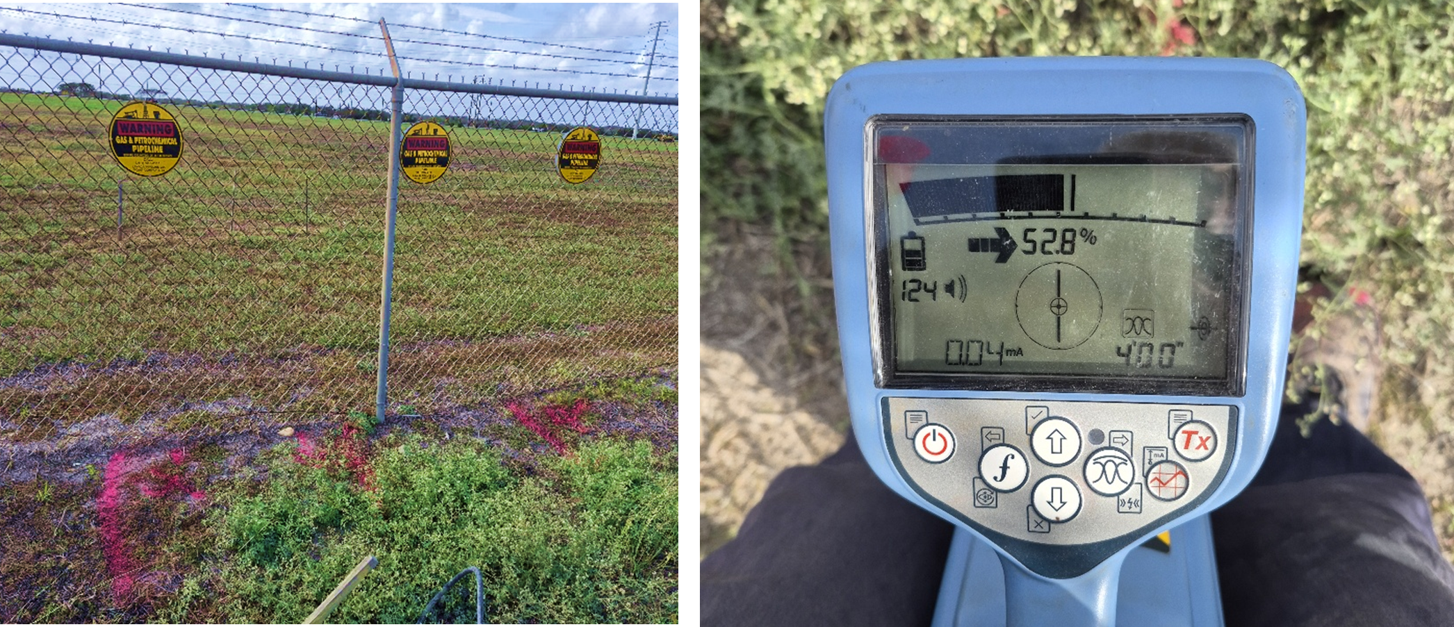
The images below show the field detection process. OmniVueNDT technicians used electromagnetic locators to trace buried utilities, marking their positions with high-visibility paint for verification. The locator device display shows real-time depth and signal strength readings, confirming precise utility locations during the survey.
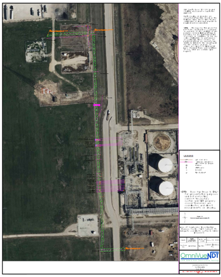
The comprehensive utility map below presents the final deliverable - an aerial view of the site with all detected utilities geo-referenced and labeled according to their known designations. This map was provided in the appropriate CRS and EPSG code format for integration into the client's engineering and GIS systems.
Why This Matters: Risks Avoided and Value Delivered
Without this investigation, the consequences would have extended far beyond budget overruns:
Safety hazards - Hitting an unknown high voltage conduit or pressurized utility could have led to serious injuries on site
Project delays - Unplanned utility conflicts could halt work while crews excavated and redesigned around unknown obstacles
Costly change orders - Repair and mitigation of utility damage usually come with hefty price tags and schedule impacts
Compliance and permitting issues - Without documentation, the team risked failing inspections or violating local utility protection standards
Thanks to OmniVueNDT’s precision subsurface imaging and utility mapping, the client moved forward with confidence, kept the project on schedule and avoided major safety or financial setbacks.
OmniVueNDT’s approach exemplifies why utility locating and subsurface awareness aren’t optional extras - they’re essential risk management tools for any modern industrial site development.
Dig Smarter, Avoid Conflict, Build With Confidence
If you're preparing for groundwork, pipe installation or site development, don’t wait for surprises underground. Contact OmniVueNDT today to schedule a subsurface utility investigation. We’ll help you avoid risk, save time and deliver with confidence.